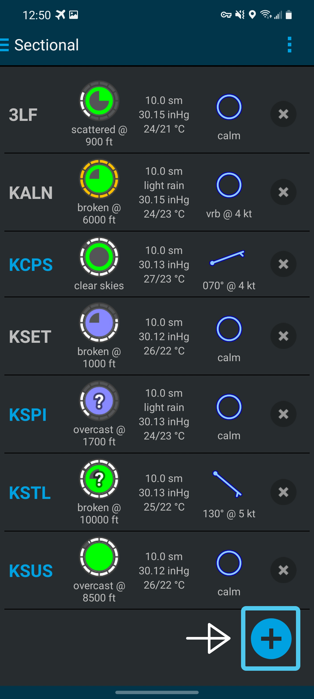
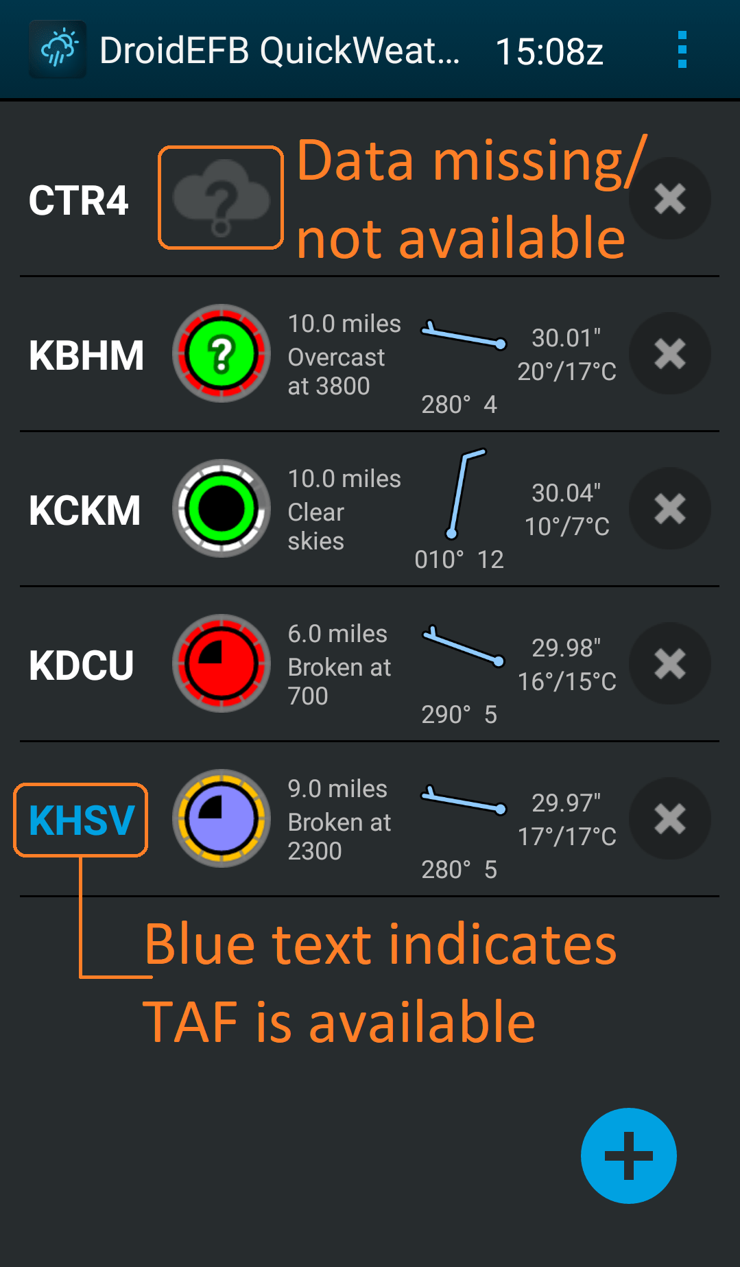
Quickly view weather by favorite airport or along an entire flight path using color coded METARs and TAFs.
QuickWeather


OVERVIEW
Developed by pilots, QuickWeather is designed to keep pilots weather-ready! Quickly view weather by favorite airport or along an entire flight path using color coded METARs, TAFs (view raw or translated, including METAR remarks) and imagery for United States airports.
NOTE: QuickWeather is a subscription free app, installed with DroidEFB.
METAR Cloud Coverage symbols are color coded using standard Flight Category definitions.
| Clear | Few | Scattered | Broken | Overcast | Missing |
|---|---|---|---|---|---|
| Category | Color | Ceiling | Visibility | |
|---|---|---|---|---|
| LIFR Low Instrument Flight Rules | Magenta | below 500 feet AGL | and/or | less than 1 mile |
| IFR Instrument Flight Rules | Red | 500 to below 1,000 feet AGL | and/or | 1 mile to less than 3 miles |
| MVFR Marginal Visual Flight Rules | Blue | 1,000 to 3,000 feet AGL | and/or | 3 to 5 miles |
| VFR Visual Flight Rules | Green | greater than 3,000 feet AGL | and | greater than 5 miles |
| NOTES: By definition, IFR is ceiling less than 1,000 feet AGL and/or visibility less than 3 miles while LIFR is a sub-category of IFR. By definition, VFR is ceiling greater than or equal to 3,000 feet AGL and visibility greater than or equal to 5 miles while MVFR is a sub-category of VFR. |
||||
INSTALLATION AND ACCESS
QuickWeather is installed as part of the main DroidEFB app and is accessed via the DroidEFB navigation drawer or by tapping the QuickWeather launcher icon.
| DroidEFB | Nearest | QuickWeather | Weight and Balance |
|---|---|---|---|
 |
 |
 |
ADDING AND SORTING AIRPORTS
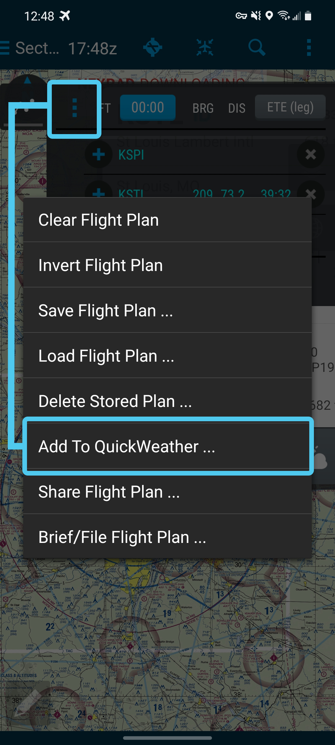
Add airports (one at a time) to QuickWeather by touching the “+” icon in the lower right corner or export them from the DroidEFB Flight Plan Tab.
Airports are sorted alphabetically (more sorting options coming in a later release).
DATA UPDATES
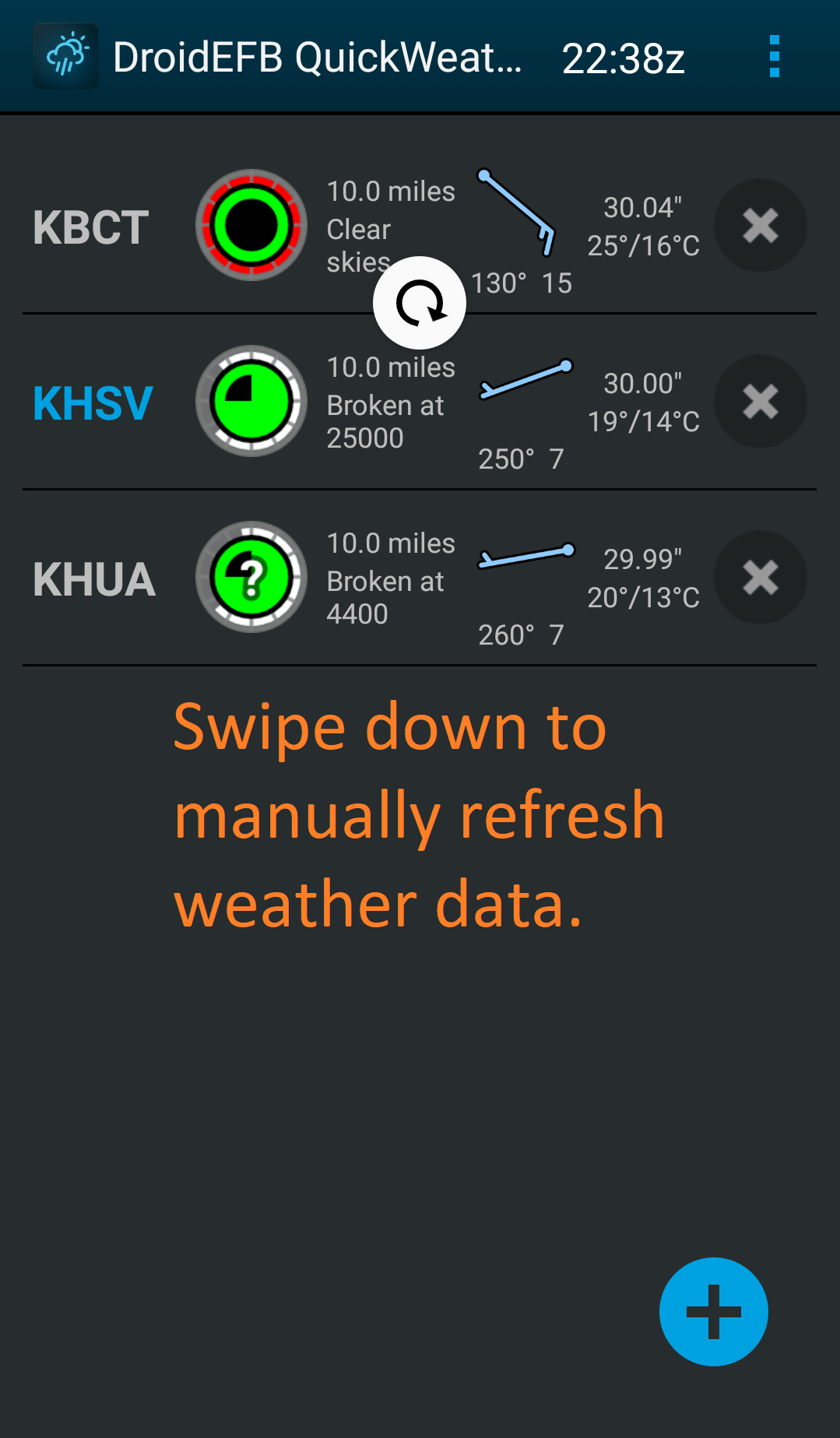
METARs are automatically updated every 5 minutes, weather imagery every 15 minutes.
Swipe down to force a manual update.
DATA CACHE
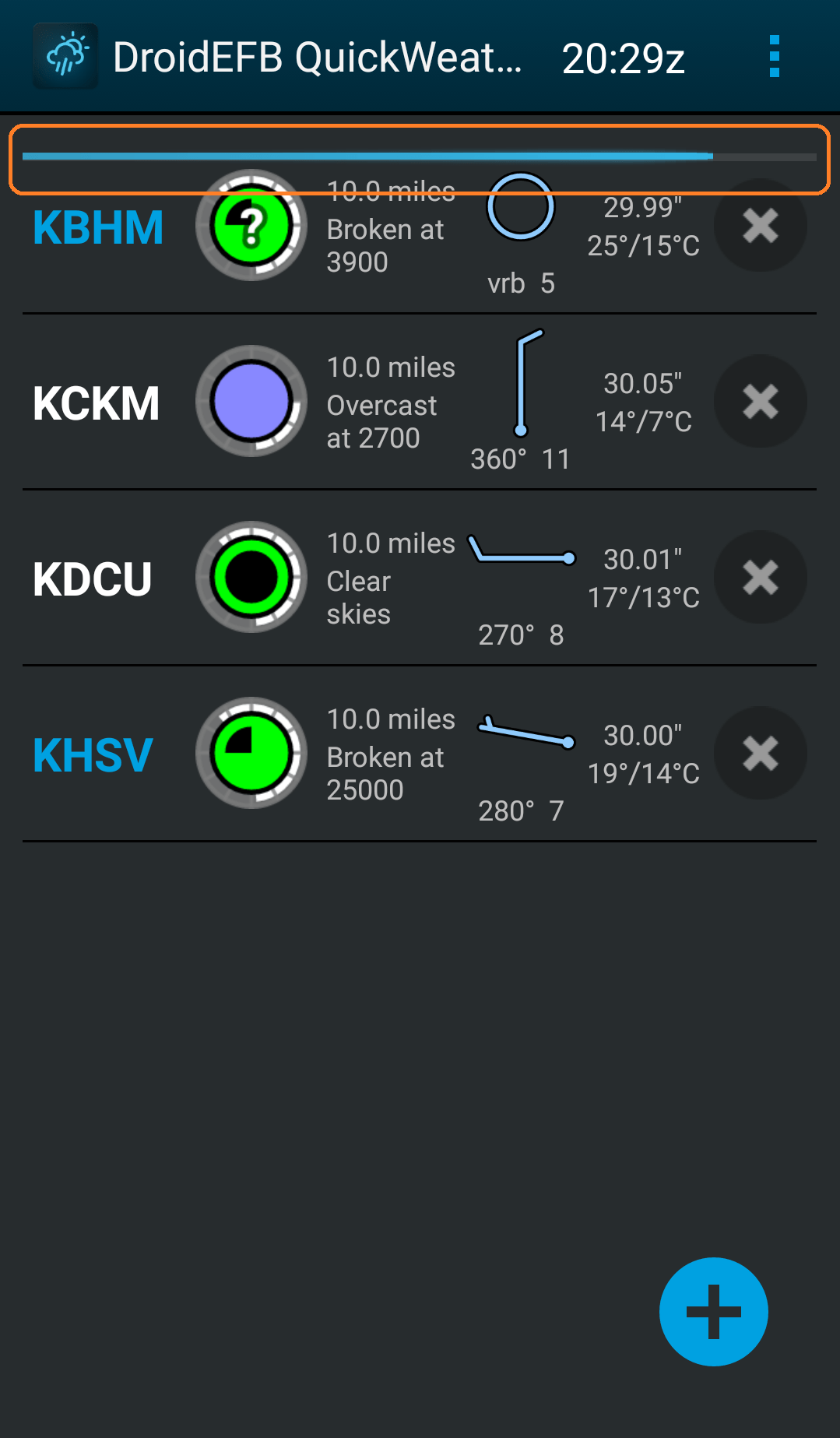
METARs and weather imagery are cached for offline use.
The progress bar at the top of the screen indicates download status.
SYMBOLOGY
The segmented circle around the outer edge of the METAR symbol corresponds to the issuance time after the hour and turns AMBER when information is 60 minutes old and RED when 75 minutes old.
Wind barbs are rounded to the nearest 5 knot increment.
A white “?” is displayed on top of the METAR symbol when a reporting station indicates maintenance is required (Indicated by a $ in the METAR text).
BLUE airport identifier indicates TAF is available.
EXPANDED VIEW
Touch an airport from the list to view METAR, TAF and imagery.
Zulu time is always displayed at the top of the screen.
Touch the toggle icon to switch between sunrise – sunset (Zulu and local time) and to switch between raw versus translated METAR and TAF.
METAR history can be toggled between textual or graphical view.
![]()
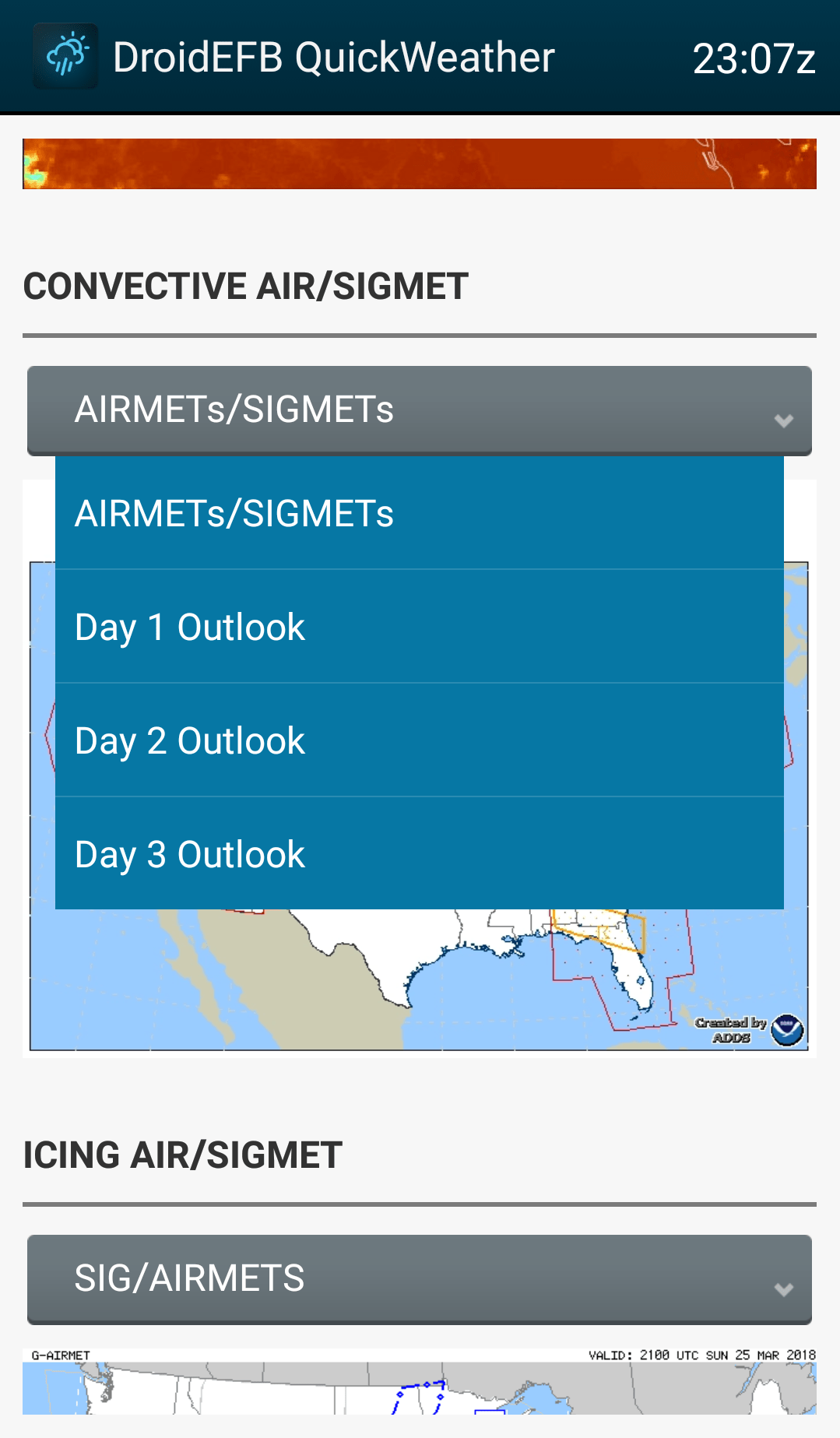
AVAILABLE DATA
Choose data via Menu > Preferences (top right, airports list view).
Available data includes METAR, METAR History, TAF, animated Radar, Radar Tops, Satellite (Infrared Color, Infrared B/W, Visible, Water Vapor), Convective Outlook (Day 1, 2 and 3), SIGMETs, Icing, Turbulence, Freezing Levels, Winds and Temperatures Aloft, Aviation Forecast (Surface and Clouds), and Regional TFR Map.
ADDITIONAL VIEWS
Touch imagery to view full screen and zoom.
NOTE: The first time imagery is viewed, an option to choose a default image viewer will appear. Some viewers display higher resolution than others. Google “Photos” is a recommended viewer for higher res imagery.
Touch TFR map to be directed to tfr.faa.gov.
