OVERVIEW
Use DroidEFB to import and export a user defined list of waypoints via csv file in a variety of coordinate formats including military grid reference system (MGRS) and universal transverse mercator (UTM).
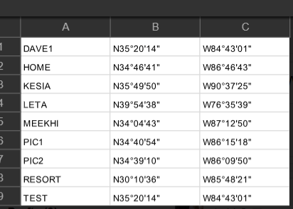
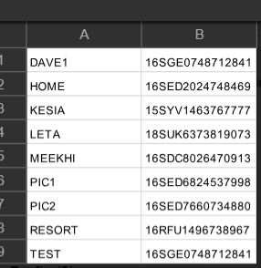
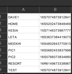
DroidEFB exports waypoints name and coordinates to csv in the currently selected coordinate display format specified in preferences. Coordinate format may be one column (MGRS or UTM) or two (regular lat,lon). When importing, DroidEFB is smart enough to figure out coordinates type – i.e., if 3 or more columns in the csv file, it assumes lat, lon. If 2 columns, DroidEFB tries both UTM and MGRS. Coordinate import/export format samples below:


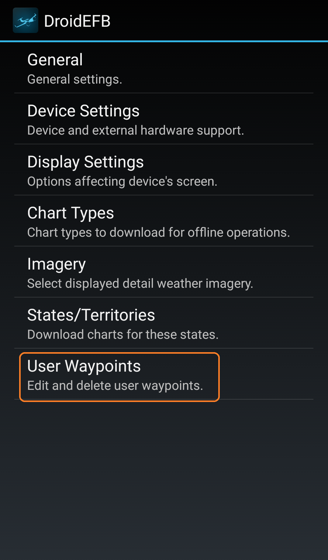
1. Navigate to Menu > Preferences > User Waypoints to see the list of user defined waypoints available for export.
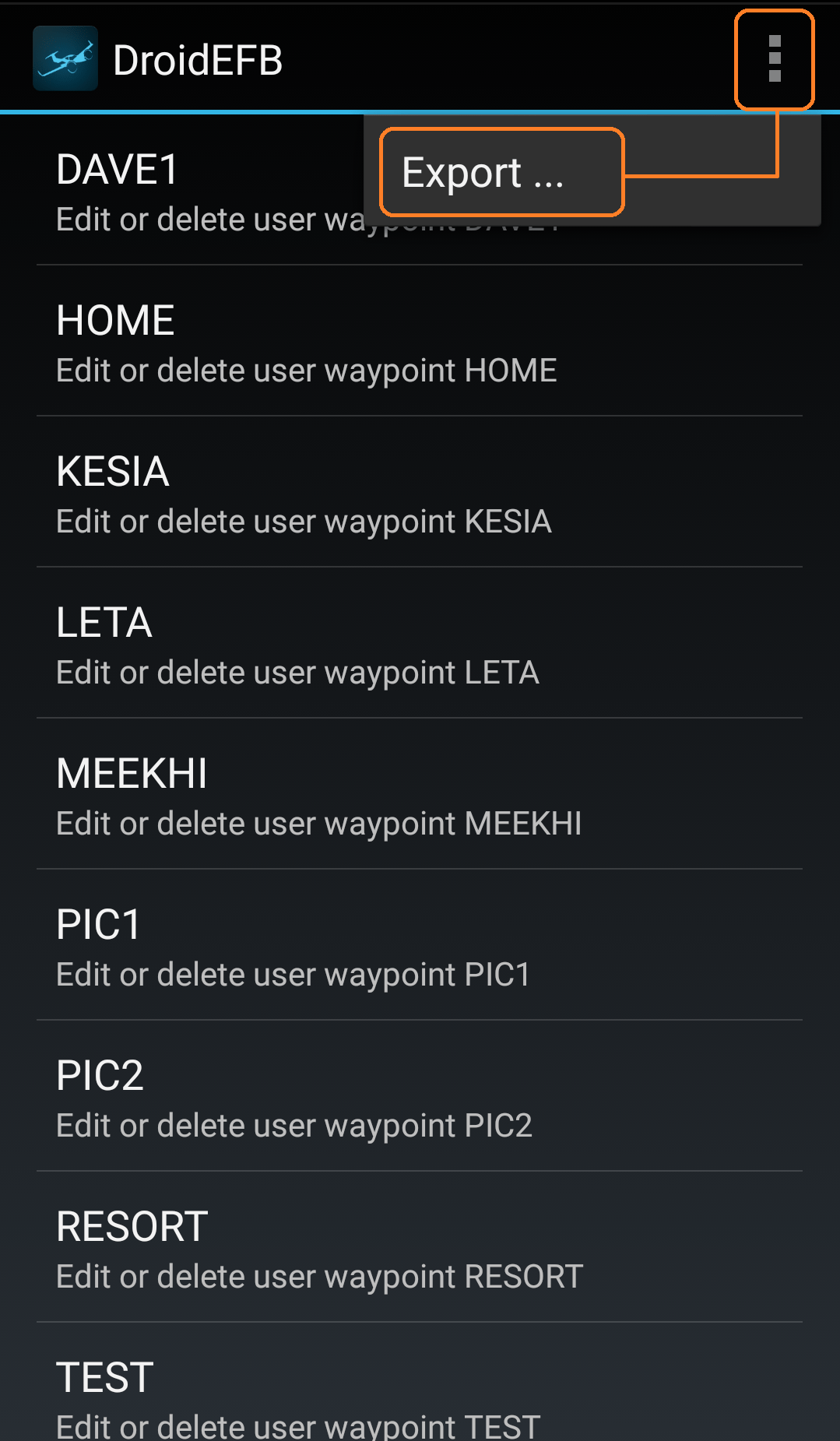
2. Touch Menu > Export.
NOTE: Waypoints are exported to csv file using coordinate format specified in Preferences > General > Coordinates Display Format.
3. The first time “Export” is selected, a prompt will be displayed to select a default Email app.
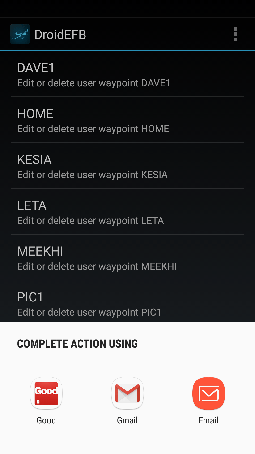
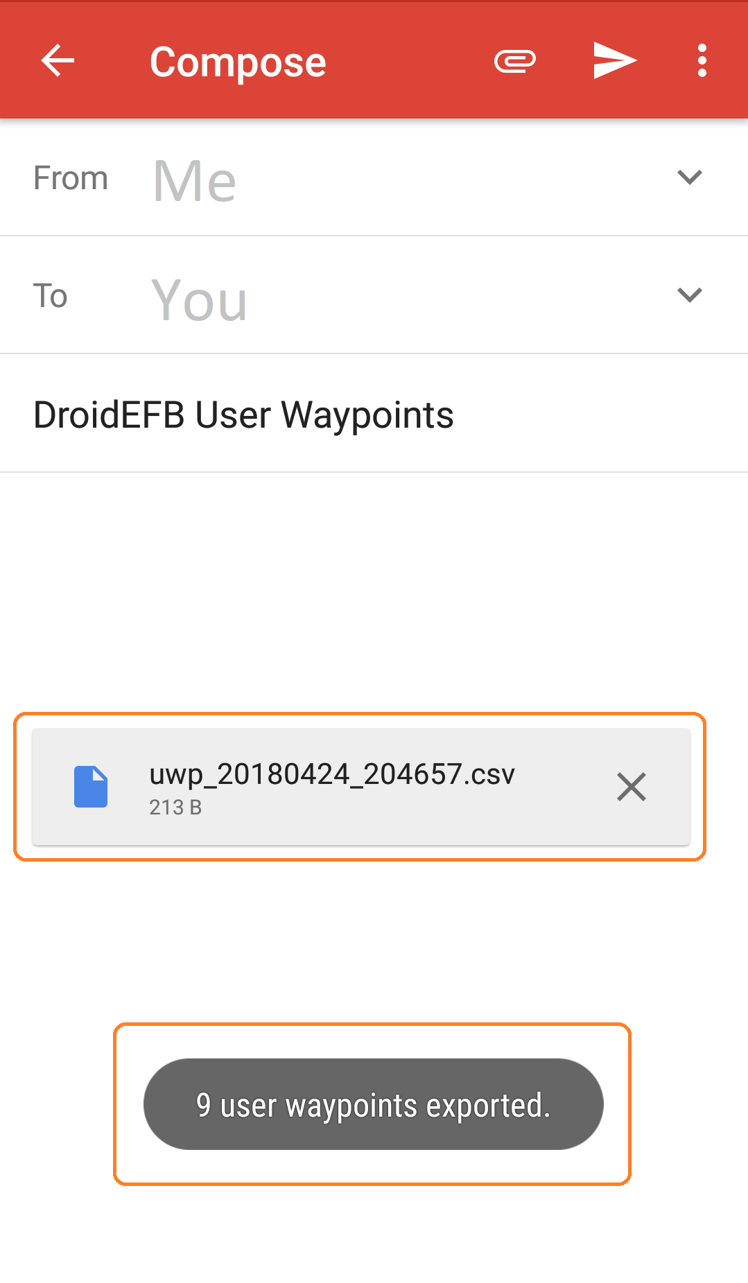
4. After selecting the desired app to use for export, that app will open and the csv file will automatically inserted as an attachment.
5. Once the recipient receives the message containing the csv file, select DroidEFB. If another app is already selected as the default, reset via the Android device settings.
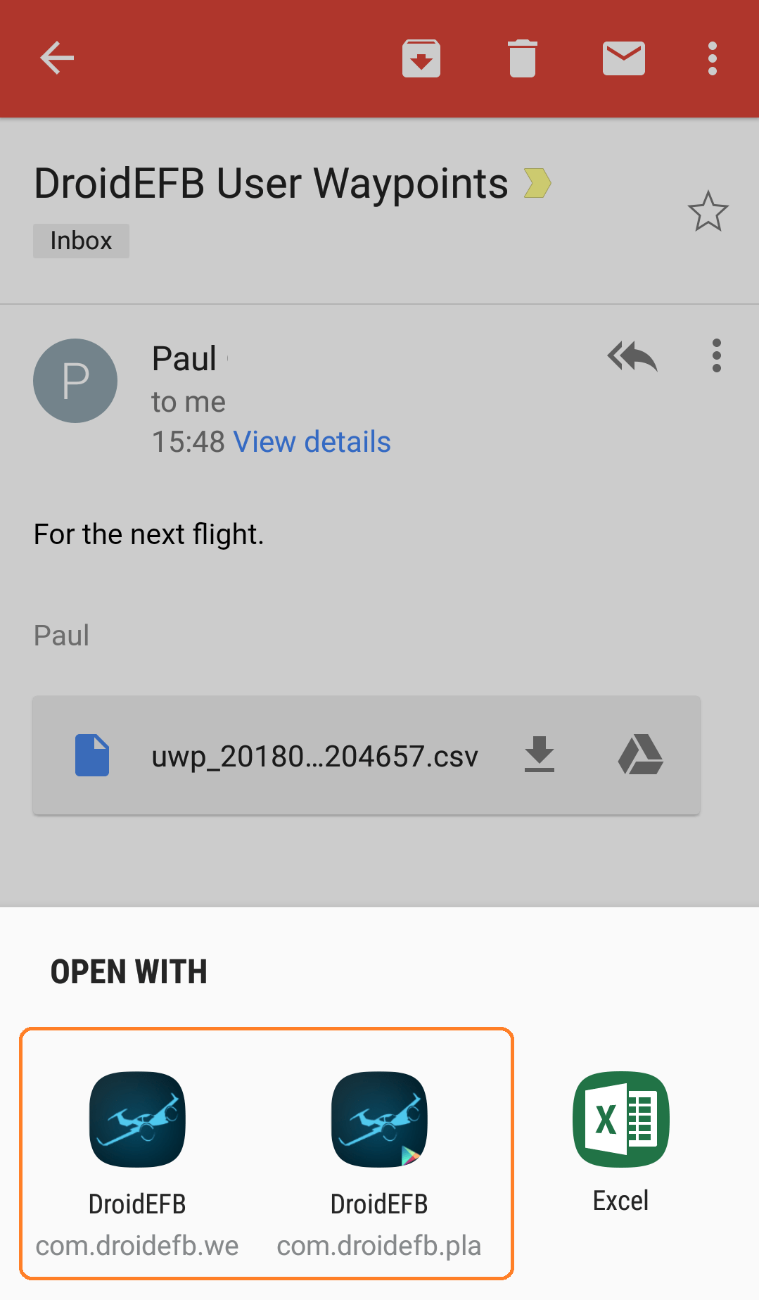
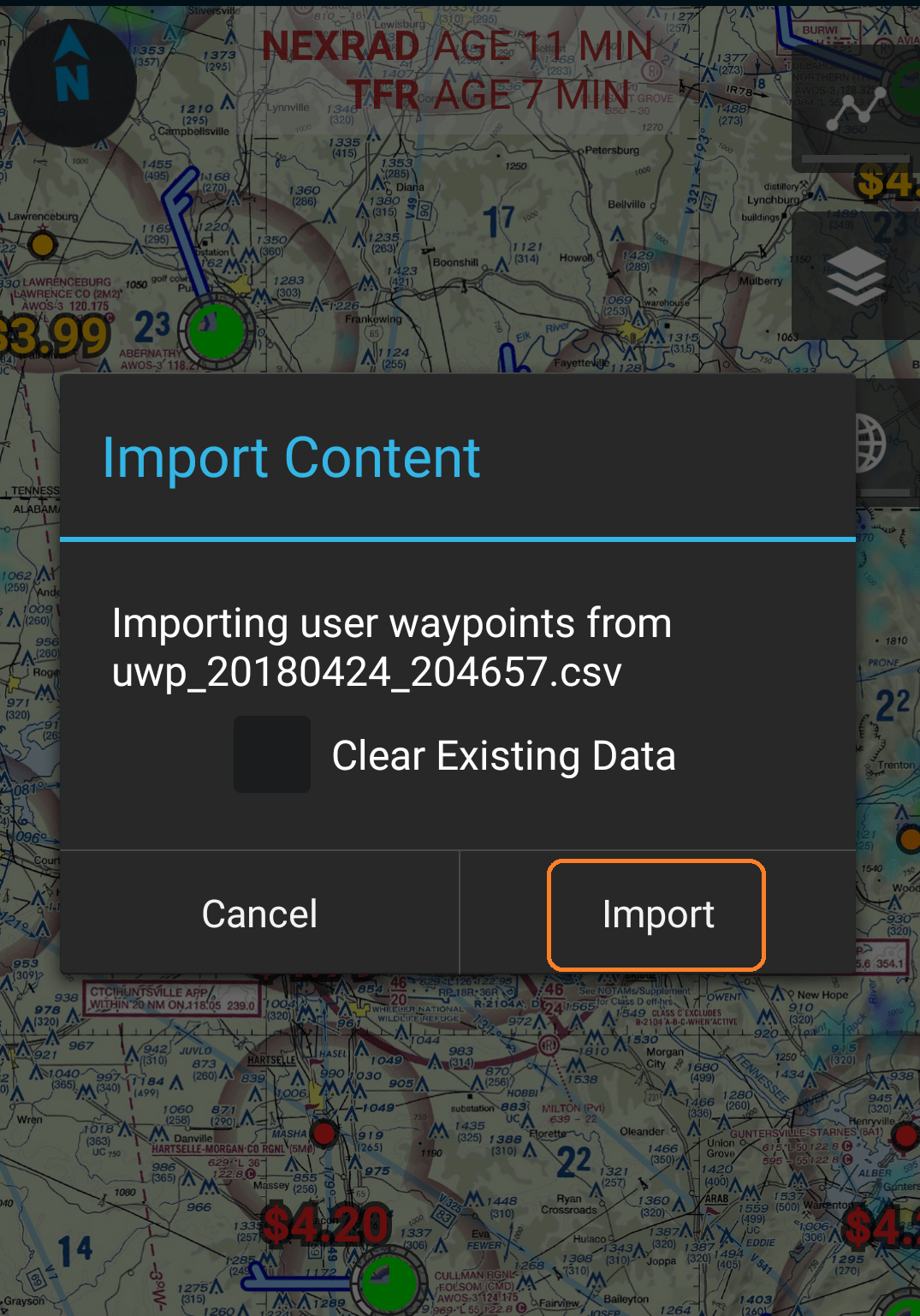
6. Once the recipient chooses DroidEFB as the app to open the csv file, the Import Content dialog will appear.
NOTE: Imported waypoints with the same coordinates will overwrite existing waypoints with the same name.